Sticky Overnight Dew Point Records For The Twin Cities
Sunday's Heat
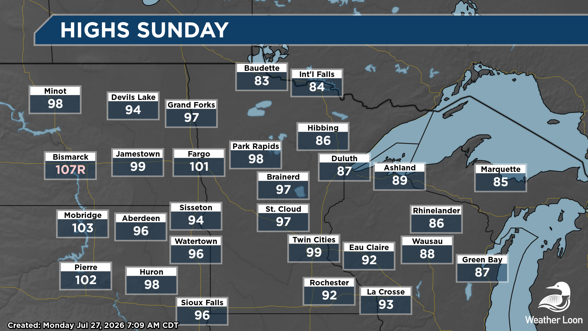
Uffda, was it a hot (and sticky) one out there on Sunday! While no record highs were set across the state, highs climbed into the upper 90s all the way up into the Park Rapids area.
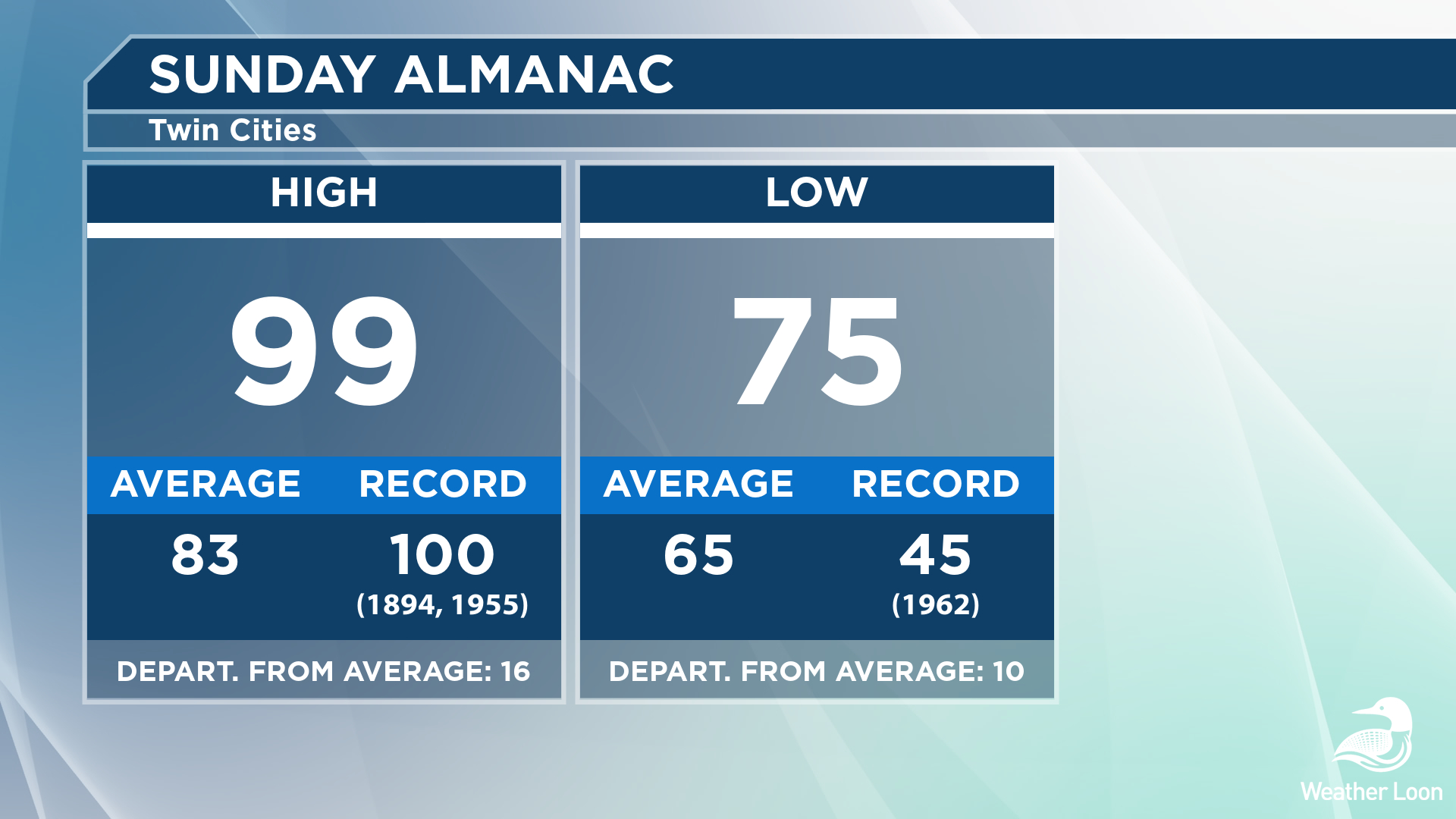
The high of 99°F at the MSP Airport, set at 4:20 PM, fell a degree shy of tying the record for the day back in both 1955 and 1894. The low also fell a degree short of the warmest July 26th low on record fo the Twin Cities: 76°F back in 1931.
Hot & Sticky Sunday Night
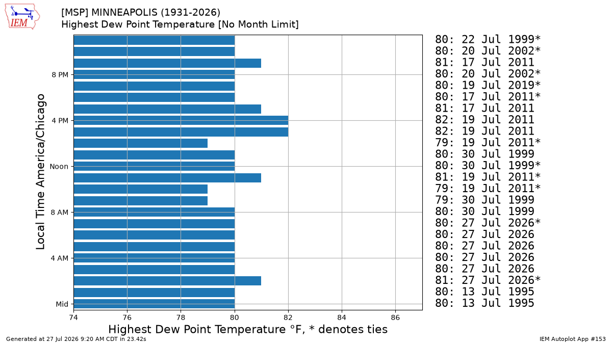
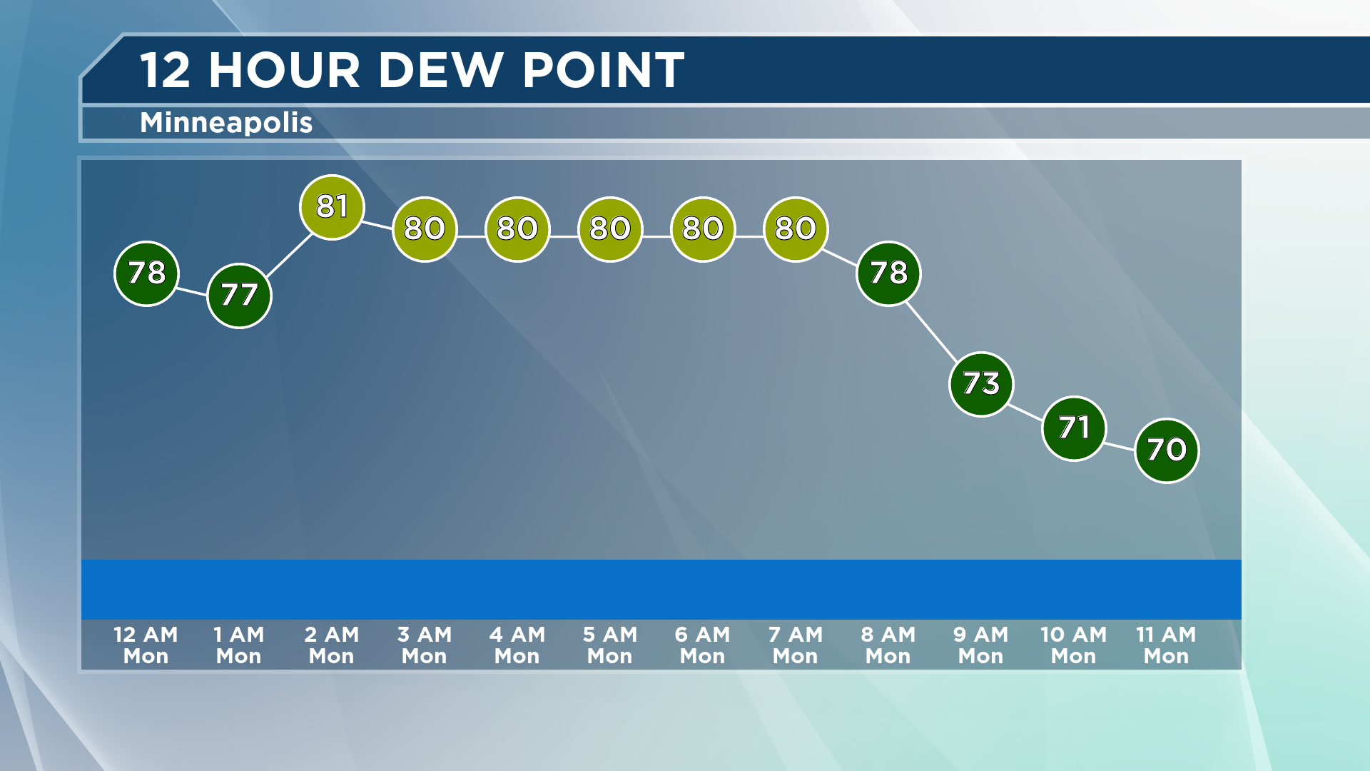
The heat and humidity continued Sunday Night. In fact, the stickiness got worse. Between 2 AM and 7 AM Monday, dew points were at or above 80°F in the Twin Cities, either tying or breaking each of the hourly records for those six hours. We peaked at an 81°F dew point at 2 AM. Only four days in recorded Twin Cities history have had a dew point of 81°F: July 17, 2011; July 18, 2011; July 19, 2011; and July 30, 1999. As my colleague Meteorologist Todd Nelson wrote about last week, the highest dew point in Twin Cities history was 82°F back on July 19, 2011.
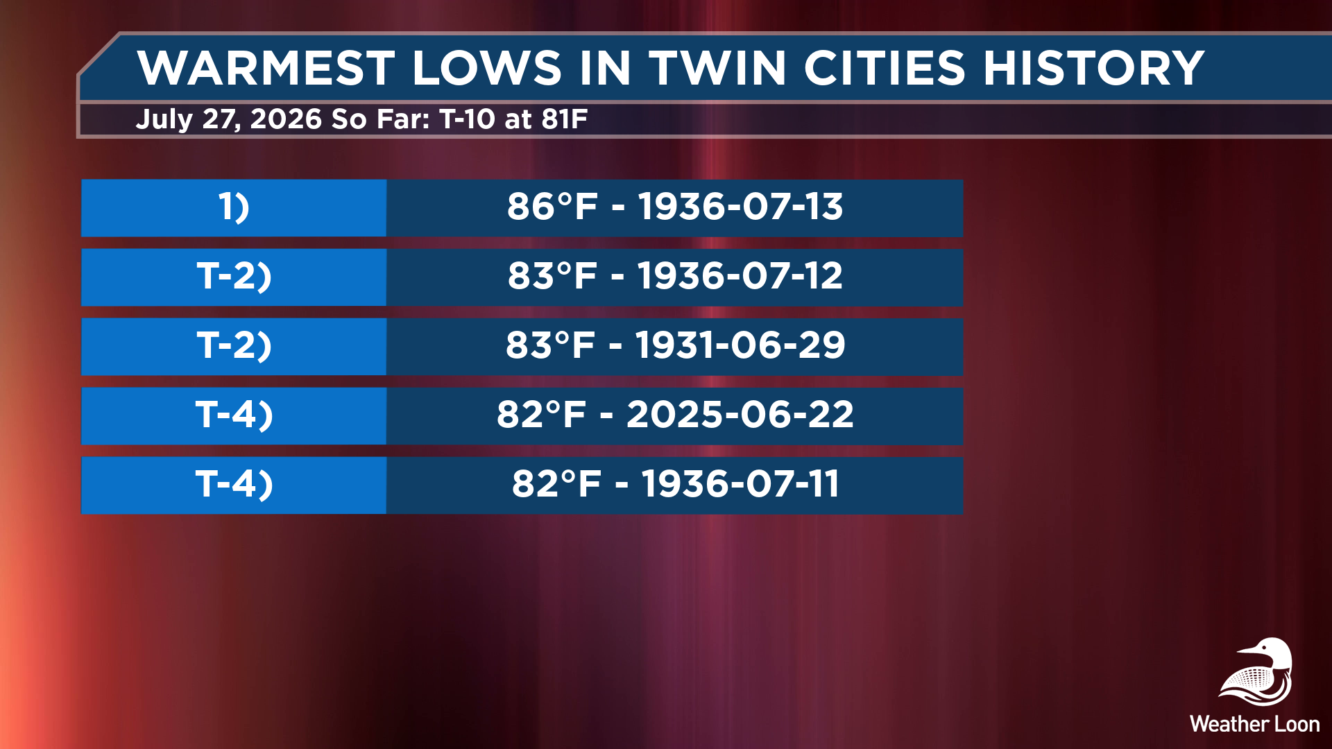
With the sticky overnight dewpoints, the morning low only dropped to 81°F at MSP Airport. That would tie today's warmest low record of 81°F set back in 1894. That would also tie for the 10th warmest low ever recorded in Twin Cities history with three other days. We will have to see if that low sticks, or if we drop lower heading toward Midnight tonight.
The warmest low ever recorded in Twin Cities history was back on July 13, 1936, when it only dropped to 86F. That Dust Bowl heat wave also brought the Twin Cities the warmest high on record on July 14th at 108°F.
Not As Humid Monday
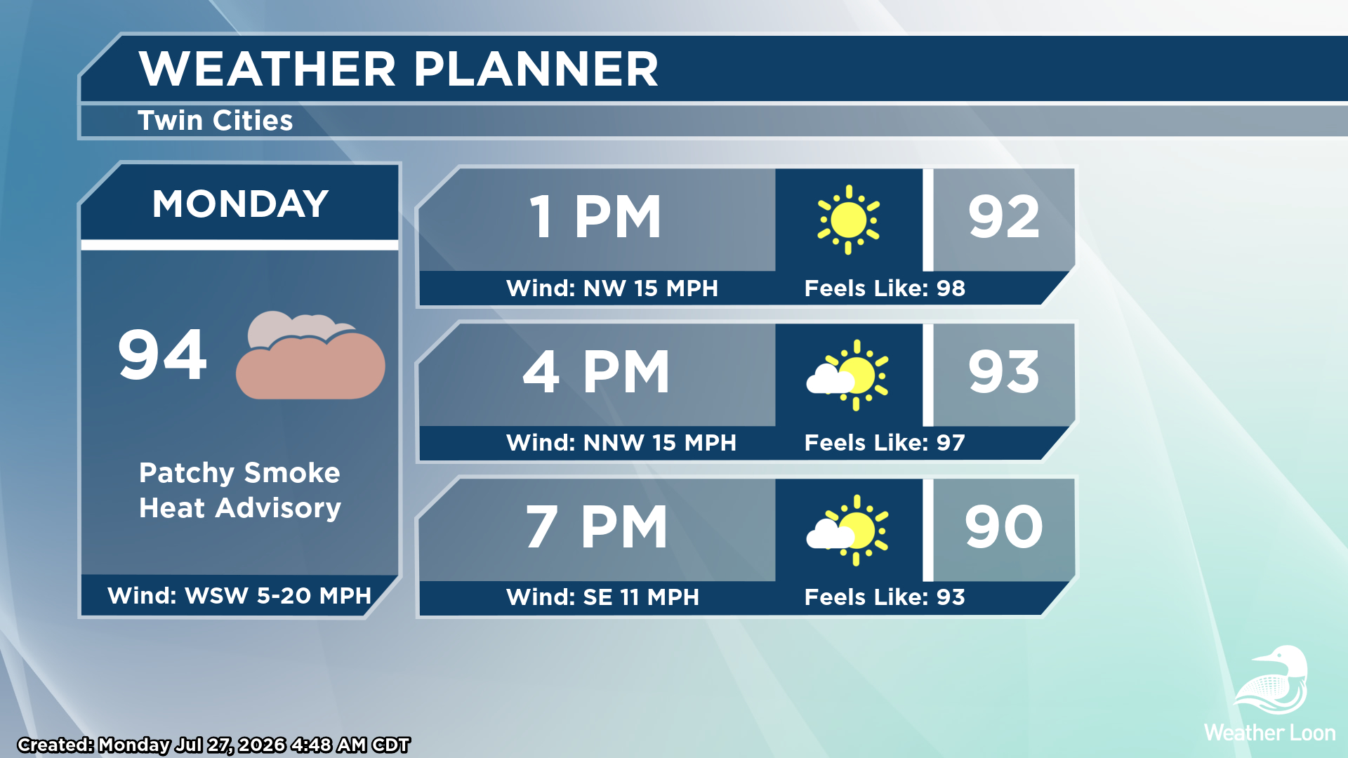
The good news is that dew points are falling as we head through Monday, meaning it won't feel as sticky out there heading into the afternoon hours. Already by 10 AM, the dew point had dropped to 71°F at MSP Airport. However, the heat is sticking around, with highs climbing into the mid-90s. With those lower dew points, those mid-90s will feel more like 100F. Hazy/smoky sunshine is expected, as the "cold" front bringing in our lower dew points is also dragging smoke in from the fires burning out in the Pacific Northwest.
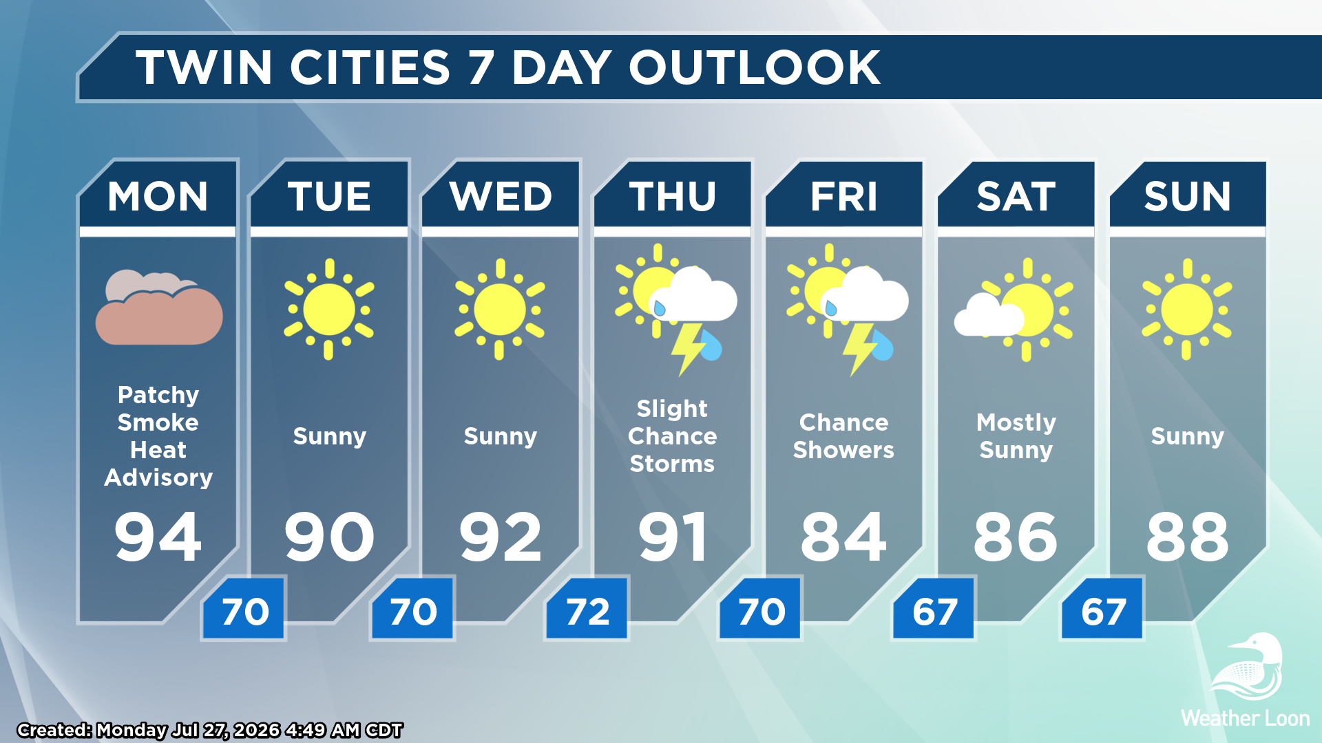
While we remain in the 90s for highs through the middle of the week in the Twin Cities, we will watch a system approach that could bring us our next best chance of rain Thursday Night into Friday. That will also help drop temperatures closer to average for the end of the week as we round out July and head into August.
For your latest Minnesota forecast all the time, check out your local forecast on our front page, and you can watch our livestream and our meteorologist-hosted weather forecasts over on YouTube - don't forget to subscribe!