Sweltering Heat Wave Dominates Minnesota To Start July
July Heat Wave
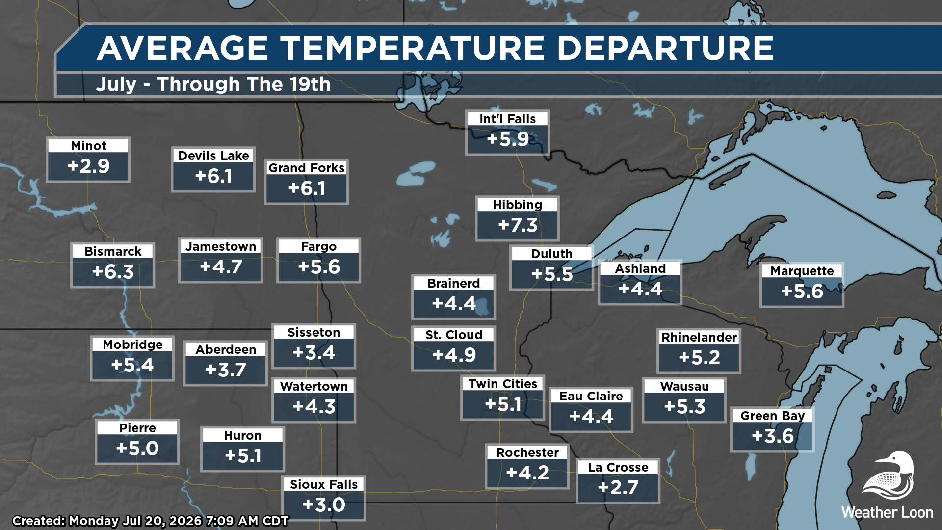
Air conditioners have been working overtime so far this month across the state of Minnesota, as we have seen the heat over the first two-thirds or so of July. As we look statewide, average temperatures at climate sites have been at least 4F degrees above average through July 19th, including 7.3F above average in Hibbing. Out of 88 years of record-keeping in Hibbing, this is the second warmest start to July on record.
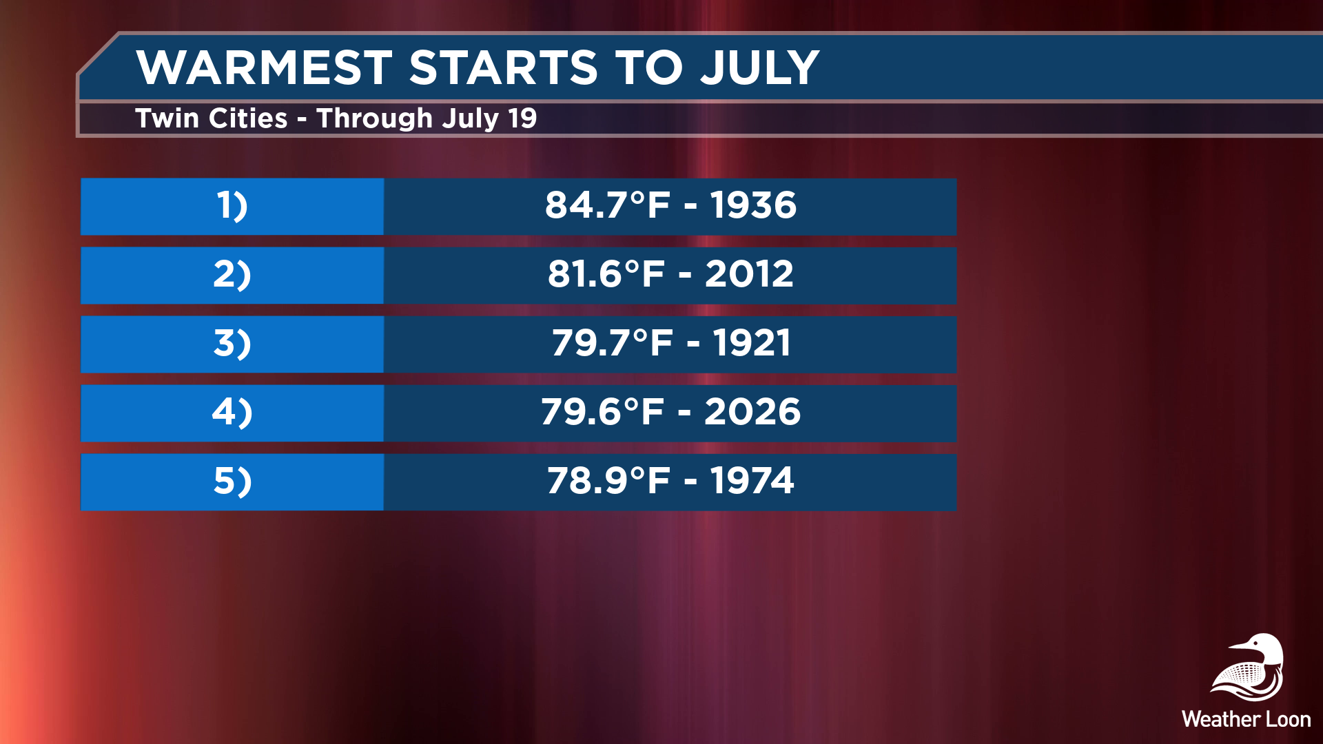
In the Twin Cities, our average temperature so far this month has been X. That is 5.1F degrees above where we typically would be through July 19th, and the fourth warmest start to the month! Of course, we aren't close to topping 1936 or 2012, both of which saw 100F+ degree days during the month of July. The warmest we've been so far this month was 96F on the 15th.
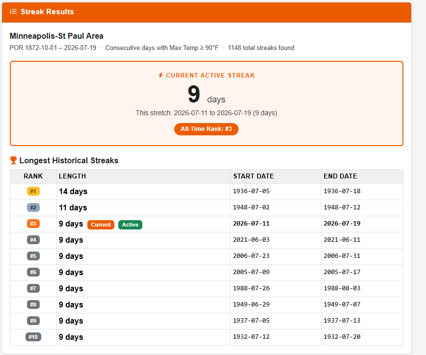
Our hot ranking in the top five has come off the back of at least a nine-day stretch where highs have been at 90F or above in the metro. That has occurred between July 11th and 19th, and placed us in a tie for the third-longest stretch on record. If we are able to get to 90F this (Monday) afternoon, we would pull into sole possession of 3rd with 10 straight days.
UPDATE:
MSP Airport has now hit 90F this (Monday) afternoon for the tenth day in a row - and we are now in sole possession of the third-longest 90°F+ streak on record. #mnwx
— Weather Loon (@weatherloon.com) July 20, 2026 at 2:47 PM
[image or embed]
Slightly Cooler... Until The Weekend
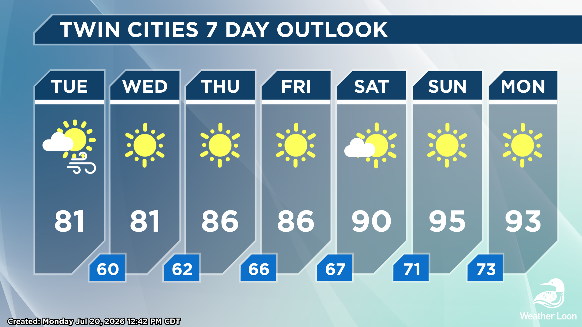
The good news is that we won't make it to 11 straight days as get a bit of a break in the heat as we go through the rest of the work week, with highs in the low to mid-80s expected. It'll also feel less humid out there, and you might even be able to open some windows at night - depending on what the wildfire smoke wants to do, of course. Unfortunately, our reprieve from the 90s won't last too long, as models indicate highs rising back into the 90s for this weekend and early next week. There won't be too many rain chances either, as we just continue to dry out even farther across the region. Including the rain this morning at MSP Airport, the Twin Cities are sitting at 1.80" of rain for the month (1.09" below average).
For your latest Minnesota forecast all the time, check out your local forecast on our front page, and you can watch our livestream and forecast segments over on YouTube - don't forget to subscribe!