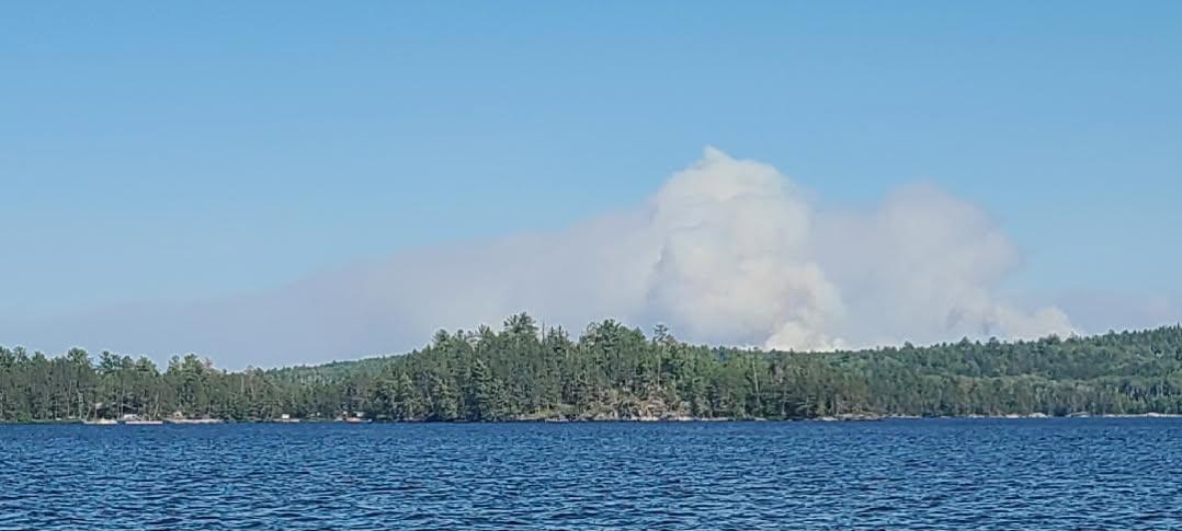
Northern Minnesota Wildfires Burn - Hot Week Of Weather
Ongoing Wildfires Up North
Last Monday, we saw thunderstorms impact portions of northern Minnesota with lightning but little precipitation. This caused several small wildfires to ignite, which were found throughout the last week. While all of these started small, recent hot, windy weather has allowed several of them to grow in scale. As of Sunday evening, it was reported that there were 20 active wildfires in the Superior National Forest, five of which were in the BWCAW. Several wildfires are also burning in Quetico Provincial Park up in Ontario.
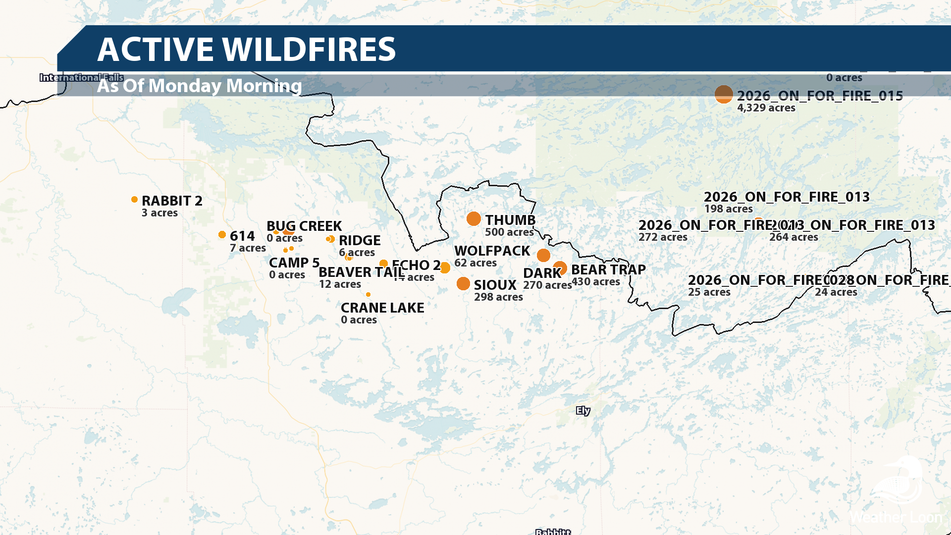
The hot, dry, windy conditions have prompted the Minnesota DNR to place campfire bans across Cook, Lake, and northern St. Louis counties, and additional campfire bans have been put in place across the entire Superior National Forest. Meanwhile, while parts of the BWCAW were closed off this weekend due to both Canadian and northern Minnesota wildfires, a new BWCAW-wide closure will go into effect Tuesday morning (July 14) at 12:01 AM for both overnight and day trips. This is to help protect the health and safety of both firefighters and visitors. The last time there was a BWCAW-wide closure was back in 2021 when the Greenwood Fire was burning near Isabella, according to Paddle & Portage.
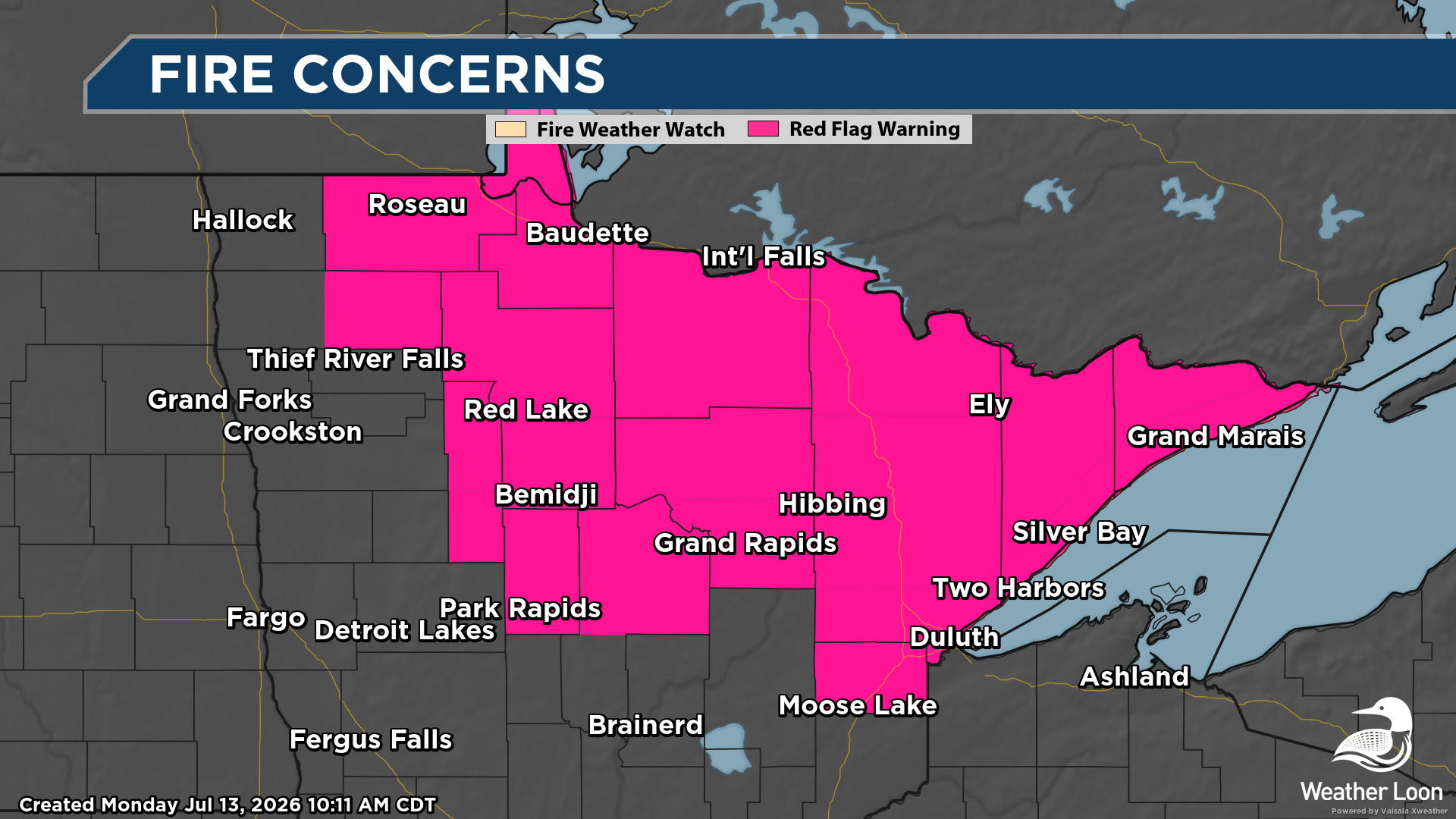
Fire weather concerns are in place once again this Monday, with Red Flag Warnings stretching across a good portion of northern Minnesota. These are in place due to the gusty winds expected, as well as the hot and dry conditions that are in place. Any new or ongoing wildfires could quickly spread. Meanwhile, across North St. Louis and Northern Cook and Lake counties, Fire Weather Watches are in place for Tuesday afternoon and evening for the continued potential of fire weather conditions.
Hot Week Of Weather
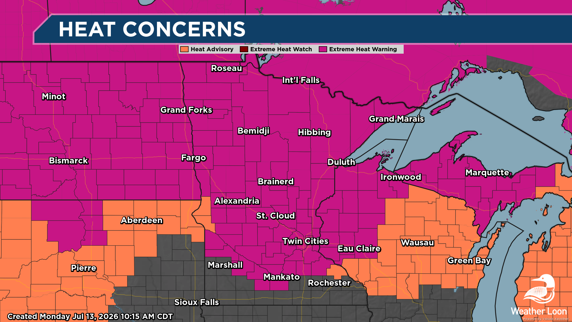
The other story we will be tracking this week is the heat, as highs will soar into the 90s each day during the work week (and even into next weekend). Due to the prolonged stretch of dangerous heat, Extreme Heat Warnings are in place across northern Minnesota into Tuesday and across central and southern Minnesota through Thursday.
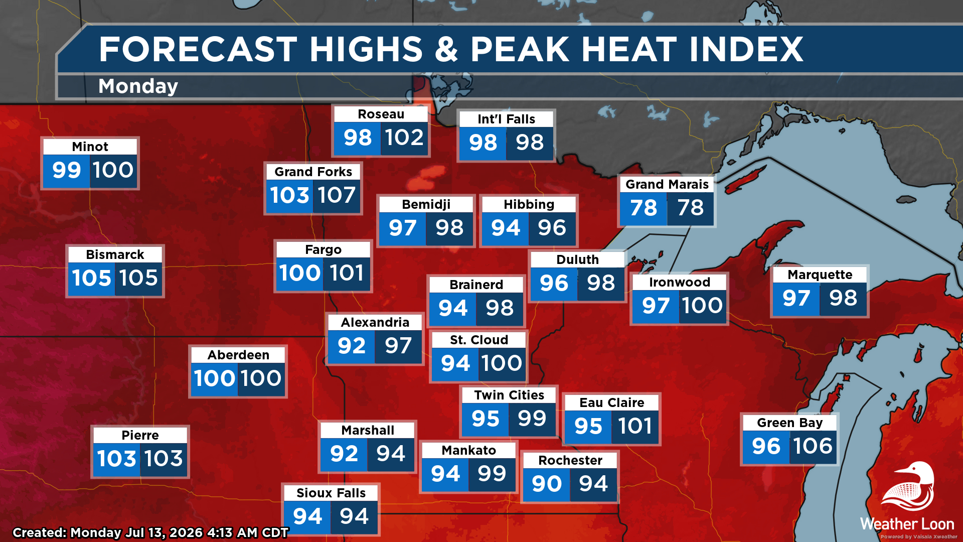
It's going to be a scorcher of a day (and week) across the state. It's actually going to be warmer up in northern Minnesota today, where places like Roseau and International Falls are making a run toward the century mark, versus southern Minnesota! Once you factor in the humidity, though, it will feel like the 100s in spots.
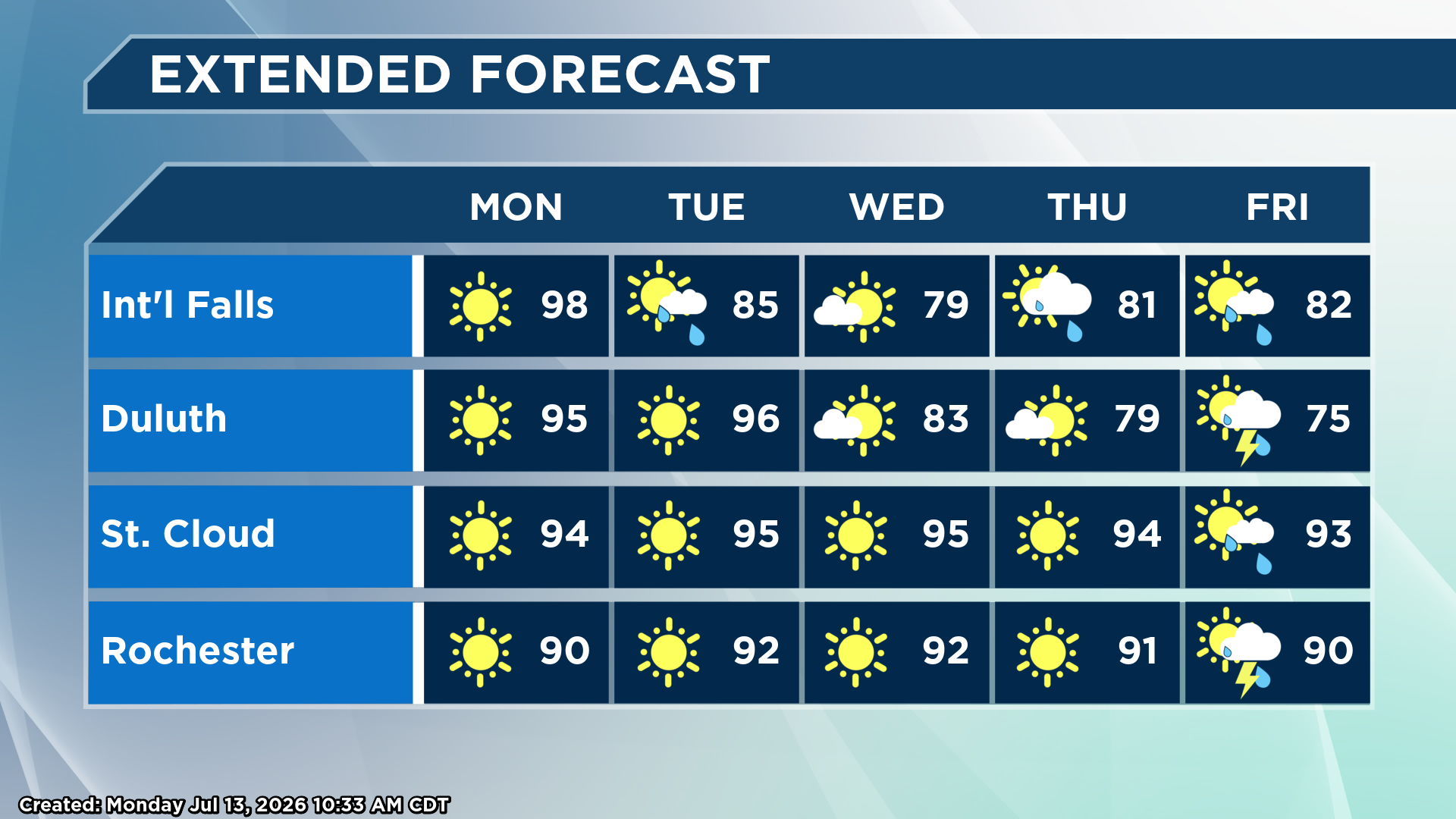
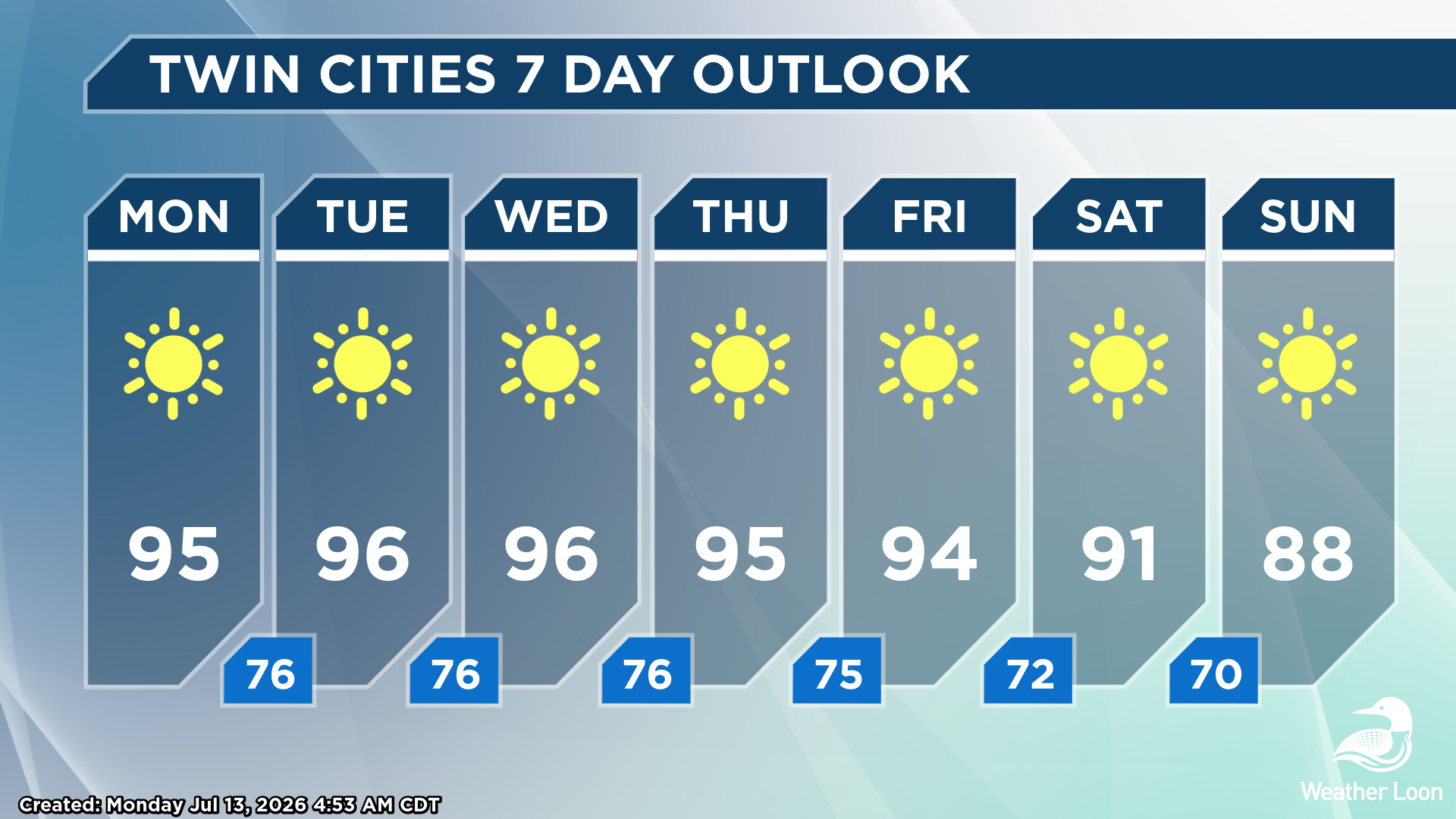
While the heat will subside a bit heading into the middle of the week across northern Minnesota, we will see the heat continue down south, with a stretch of 90s into early next weekend for areas like the Twin Cities, St. Cloud, and Rochester.
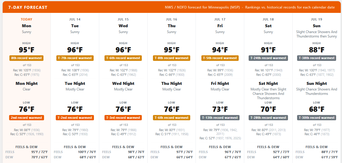
While it will be hot, we are not likely to see any record highs in the metro. Records this time of year are in the 100s, including the all-time high of 108F set back on July 14, 1936. There's the chance that a few of the morning lows through mid-week could be at least a top-five warmest for the day.
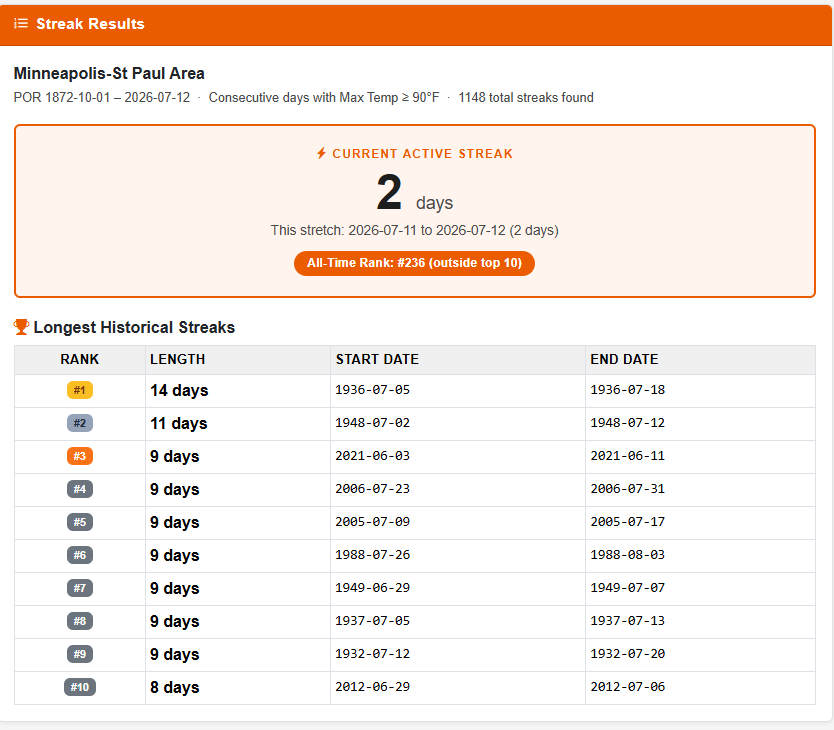
If we can make it to next Saturday with each day topping 90F in the metro, we would tie for the tenth-longest stretch of 90F degree weather at eight days. However, if we could get next Sunday in the picture, we would tie for the third longest on record at MSP.
Make sure you are taking plenty of breaks if outside the next few days and staying hydrated with water. Also, check on populations vulnerable to the heat and help out in whatever ways you can. You can also keep up to date on the wildfires and heat this week by checking out our livestream on our front page.