Noctilucent Clouds: Nature's Shining Night Clouds of Summer
Noctilucent Clouds: Nature's Shining Night Clouds of Summer
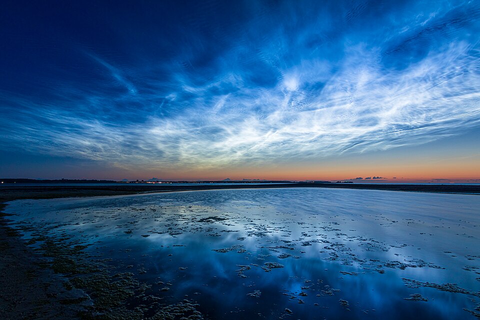
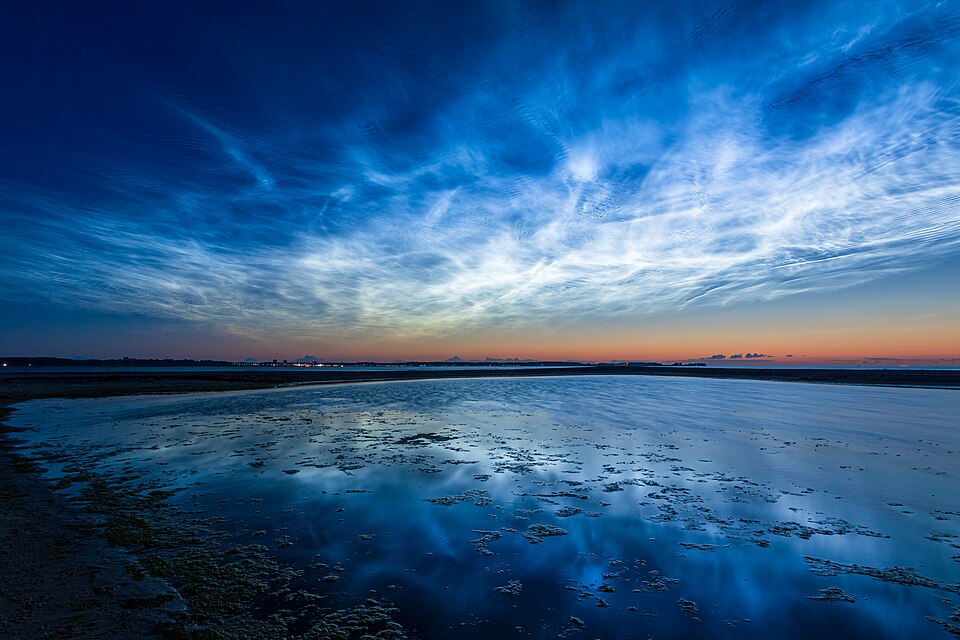
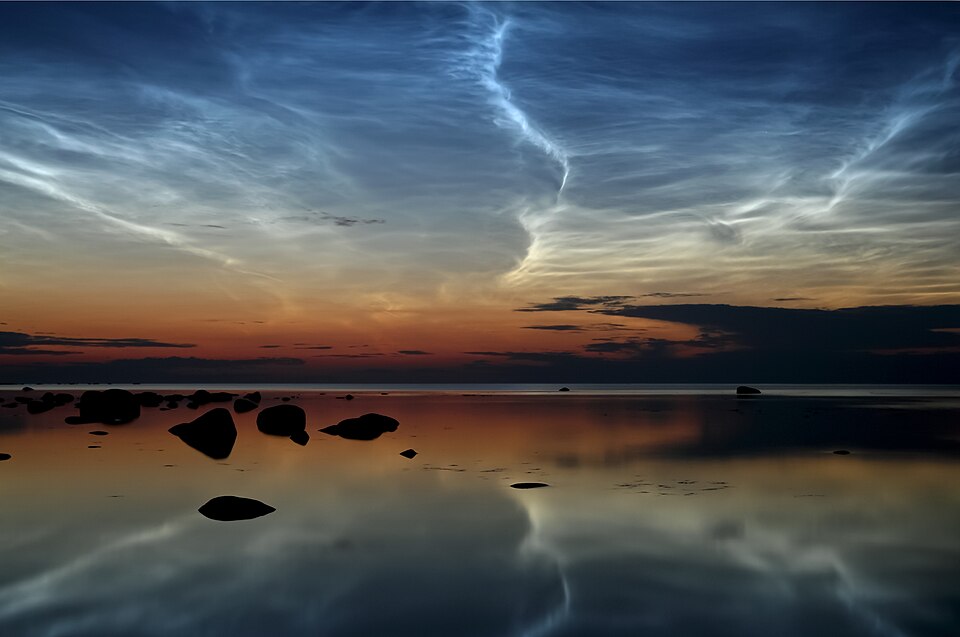
If you've ever stepped outside on a warm summer night and noticed glowing, electric-blue wisps stretching across the northern horizon, you may have witnessed one of the atmosphere's rarest and most beautiful displays: Noctilucent Clouds.
Unlike the puffy cumulus clouds that drift overhead or towering thunderstorms that rumble across the landscape, noctilucent clouds exist at the very edge of space. They shimmer long after the sun has set, creating an almost otherworldly display that has fascinated sky watchers for more than a century.
Many people initially mistake them for thin cirrus clouds, but their brilliant blue glow and nighttime appearance quickly set them apart. Some displays can stretch across hundreds of miles of sky.
What Does "Noctilucent" Mean?
The name Noctilucent comes from two Latin words:
Nocto - meaning Night
Lucent - meaning Shining or Glowing
Put together, noctilucent literally means "Night-Shining."
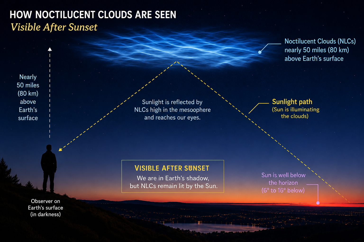
The name is fitting because these clouds remain illuminated by the sun even though it's dark where you're standing.
The Highest Clouds in Earth's Atmosphere
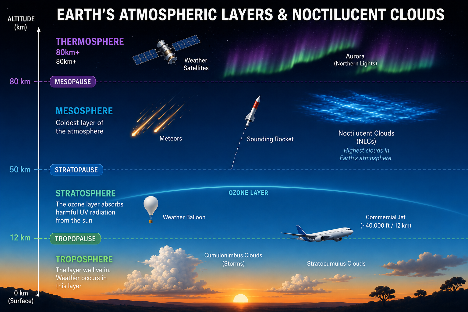
Noctilucent clouds hold an impressive distinction, they are the highest clouds in Earth's atmosphere.
Most clouds form within the troposphere, generally below 40,000 feet (12 km). Even the highest clouds can top out around 60,000 feet (or higher) near the Equator, which are known as tropical cirrus or cumulonimbus anvils.
Noctilucent clouds, however, form nearly 50 miles (80 kilometers) above Earth's surface in a region known as the Mesosphere. At this altitude, the atmosphere is incredibly thin, less than one-millionth the air pressure found at sea level.
To put that into perspective:
| Cloud Type | Typical Height |
|---|---|
| Stratus | 0–6,500 ft |
| Cumulus | 2,000–6,500 ft |
| Cirrus | 20,000–60,000 ft |
| Noctilucent Clouds | ~264,000 ft (80 km / 50 mi) |
What Are They Made Of and How Do They Form?
Despite appearing bright and luminous, noctilucent clouds are incredibly delicate. They're composed of tiny ice crystals that form on microscopic particles known as meteoric dust.
Every day, Earth is bombarded by tons of tiny meteoroids. As these particles burn up entering the atmosphere, they leave behind microscopic dust particles high in the mesosphere.
These particles become the perfect nuclei for water vapor to freeze onto when temperatures become cold enough. The resulting ice crystals are astonishingly small, far smaller than those found in ordinary cirrus clouds.
Forming ice crystals nearly 50 miles above Earth isn't easy. Three ingredients must come together:
Extremely cold temperatures (often below -180°F (-120°C))
Tiny amounts of water vapor
Meteoric dust particles or volcanic ash provide a surface for ice crystals to grow
Ironically, although it's summer at the surface, the mesosphere actually reaches its coldest temperatures during the summer months over the polar regions.
Powerful atmospheric circulation transports air upward during summer. As the air rises, it expands and cools dramatically, creating the frigid temperatures necessary for ice crystals to develop.
Without this extreme cooling, noctilucent clouds simply wouldn't exist. During summer:
The mesosphere is at its coldest.
The Sun never travels very far below the horizon at northern latitudes.
While your location is in darkness, the Sun is still illuminating the clouds nearly 50 miles overhead.
This creates the perfect geometry. The ground is dark enough for you to see them, while the clouds remain sunlit from below the horizon. During winter, although the nights are much longer, the Sun sinks far too low beneath the horizon to illuminate these high-altitude clouds.
When Is the Best Time to See Them?
Across the Northern Hemisphere, noctilucent cloud season typically runs from: Late May through early August with peak viewing generally occurs in June and July. The best viewing time is about 30 to 120 minutes before sunrise and after sunset.
Look toward the northern horizon, where they often appear as glowing blue-white ribbons, ripples, waves, or delicate filaments.
They are most commonly observed between 50° and 65° latitude, making southern Canada, the northern United States, Scandinavia, Scotland, and northern Europe some of the best viewing locations.
In recent decades, sightings have become increasingly common farther south, including Minnesota, Wisconsin, and even parts of Iowa and Illinois during particularly favorable years.
Why Are Scientists Interested?
Noctilucent clouds are more than just beautiful. Scientists consider them an important indicator of changes occurring in Earth's upper atmosphere. Research suggests their frequency may be increasing because of:
Changes in upper-atmospheric temperatures
Increases in water vapor
Long-term climate trends
Variations in solar activity
Because they form in such an extreme environment, these clouds provide valuable clues about atmospheric conditions that are difficult to observe any other way. Researchers continue studying whether changes in noctilucent cloud frequency may offer insight into our changing atmosphere.
Keep Looking Up
Most of us spend our summers watching towering thunderstorms, colorful sunsets, or perhaps even the occasional rainbow.
But one of the atmosphere's most spectacular displays often happens quietly after sunset.
The next time you find yourself outside on a clear June or July evening, take a look toward the northern horizon. If you spot glowing blue waves shimmering against the twilight sky, you've likely found one of Earth's rarest clouds, a beautiful reminder that even after sunset, the atmosphere still has a few surprises waiting overhead.
Don't forget to tune into Weather Loon to watch Minnesota's weather 24/7 - check it out here: