June 1st: Meteorological Summer & Atlantic Hurricane Season
June 1st Marks the Start of Meteorological Summer
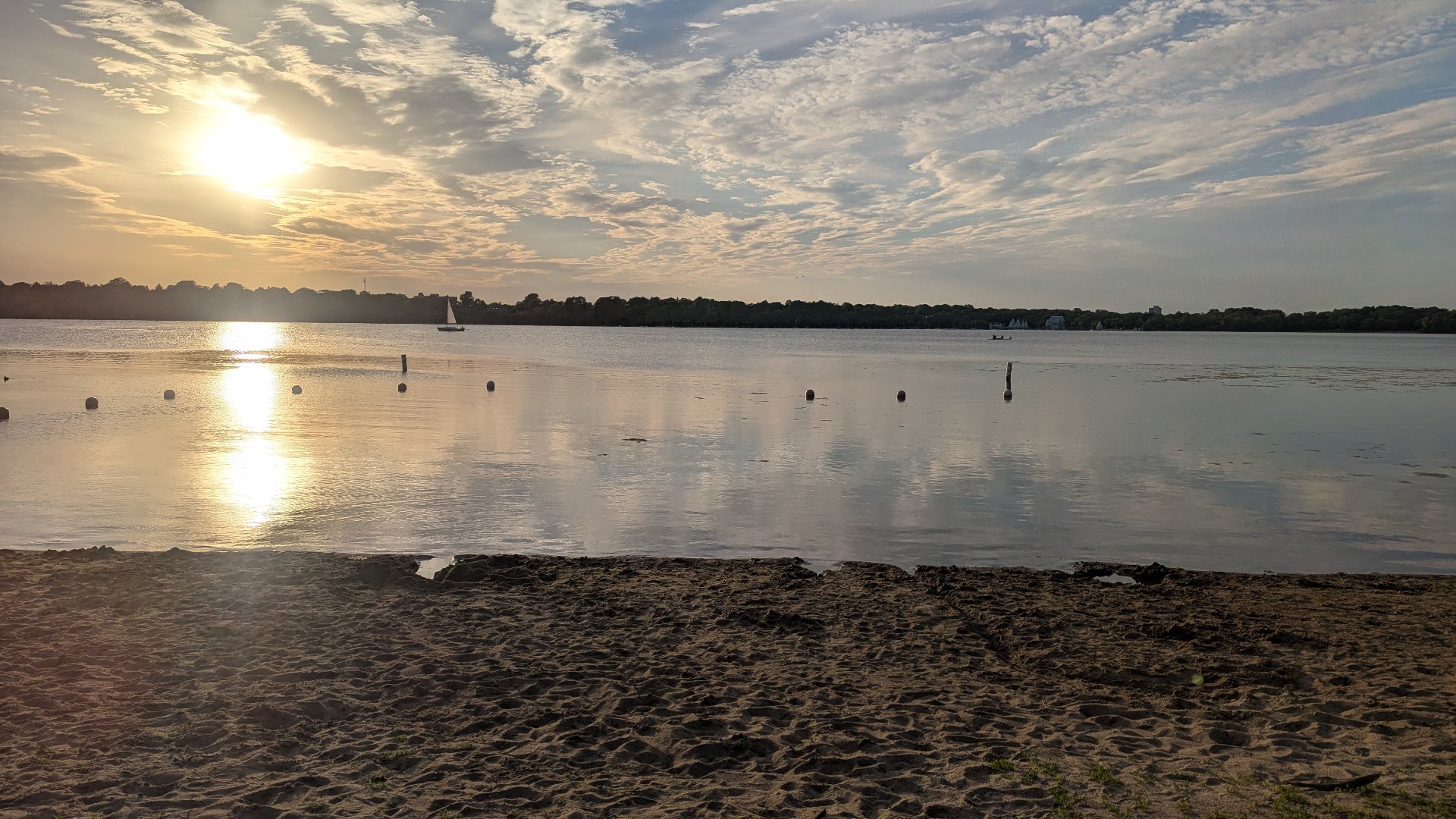
While many people associate the start of summer with the Summer Solstice later in June, meteorologists actually flip the calendar to summer on June 1st. That date marks the beginning of Meteorological Summer, a seasonal system based on temperature patterns and the calendar year rather than the position of the Earth around the sun.
Meteorological Summer vs. Astronomical Summer
Meteorological Summer runs from June 1st through August 31st, while Astronomical Summer begins on the Summer Solstice, which occurs around June 20th or 21st each year.
So why the difference?
Meteorologists divide the year into four neat three-month seasons:
Spring: March–May
Summer: June–August
Fall: September–November
Winter: December–February
This system aligns much better with annual temperature cycles and makes it easier to compare climate data year-to-year. In reality, many locations, including Minnesota, are already experiencing “summer-like” weather well before the Summer Solstice arrives.
Meanwhile, Astronomical Summer is based on Earth’s tilt and orbit around the sun. The Summer Solstice marks the longest day of the year in the Northern Hemisphere, when the sun's most direct rays shine over the Tropic of Cancer at 23.5 degrees latitude north. This year the Summer Solstice is at 3:25AM CDT on Sunday, June 21st
What Summer Means in Minnesota
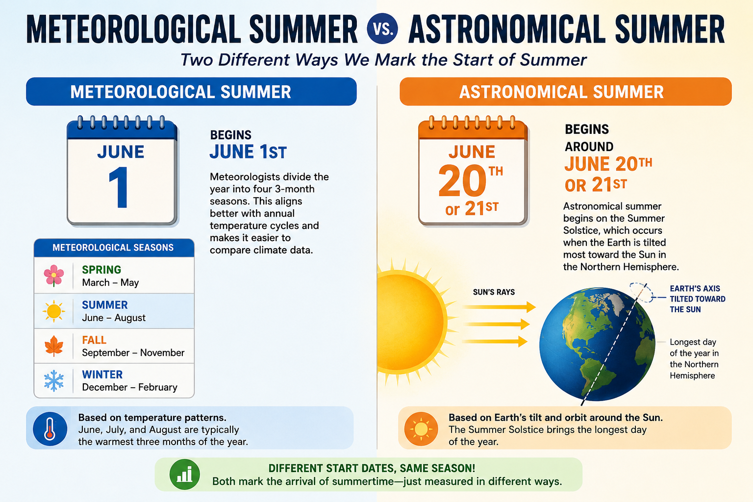
In Minnesota, June through August are typically the warmest three months of the year. Average high temperatures climb into the 70s and 80s, lakes warm rapidly, and humidity levels begin to increase.
Summer in Minnesota is also severe weather season.
Some of the most common weather events during Meteorological Summer include:
Strong thunderstorms
Tornadoes
Large hail
Flash flooding
- Heat waves
Smoky skies from Canadian wildfires
June is often one of the stormiest months of the year across the Upper Midwest as warm, humid Gulf air collides with lingering cooler air masses from Canada. The average number of Minnesota tornadoes in June is 14 based on NOAA SPC Climatology from 2001-2025. May averages 8 and July averages 9.
By July, Minnesota typically experiences its hottest temperatures of the season. In fact, the average warmest period of the year usually occurs from mid-July into early August.
Fun Summer Weather Facts
Here are a few fun facts you can add to your summer weather conversation:
The latest sunset of the year in Minnesota actually occurs after the Summer Solstice due to the way Earth’s orbit works.
Summer produces the majority of Minnesota’s annual tornado reports. Average 14 in June, 9 in July and 8 in August.
Dew points in the 70s, common during Minnesota summers, can make it feel tropical.
Some Minnesota lakes can warm by more than 20 degrees between late May and mid-July.
The Twin Cities average their warmest temperatures during the month of July.
==========
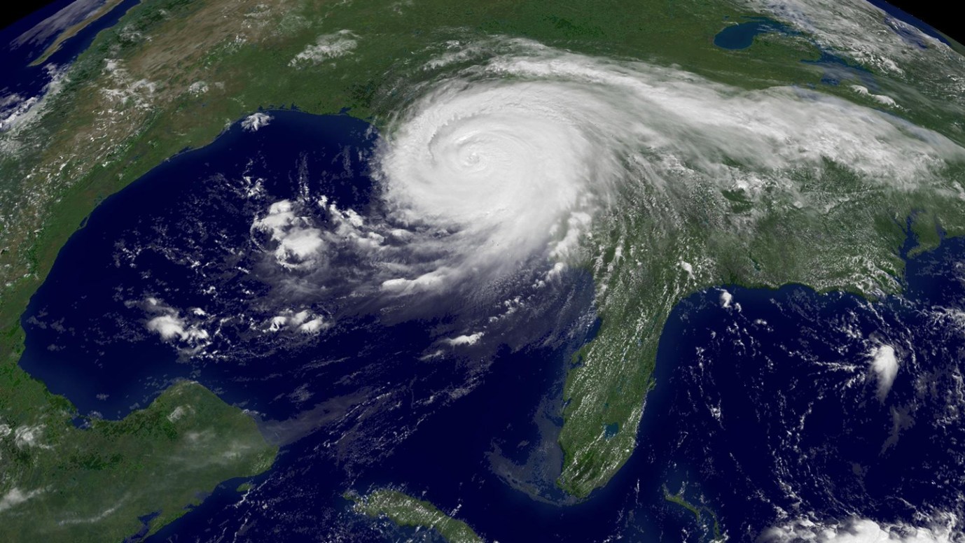
June 1st Also Marks the Start of Atlantic Hurricane Season
June 1st isn't just the beginning of Meteorological Summer, it's also the official start of the Atlantic Hurricane Season, which runs through November 30th. While tropical storms can occasionally form outside these dates, nearly all Atlantic hurricanes develop during this six-month period, with activity typically peaking between mid-August and mid-October.
The Atlantic basin includes the Atlantic Ocean, Caribbean, and Gulf of Mexico. Each year, meteorologists closely monitor ocean temperatures, atmospheric moisture, wind patterns, and large-scale climate oscillations that can either enhance or suppress tropical development.
Forecasters closely monitor:
Sea surface temperatures
Wind shear
Saharan dust
El Niño and La Niña patterns
Even though Minnesota is far from the Atlantic coast, the remnants of tropical systems can occasionally bring heavy rain and flooding into the Midwest.
What Is Expected for the 2026 Hurricane Season?
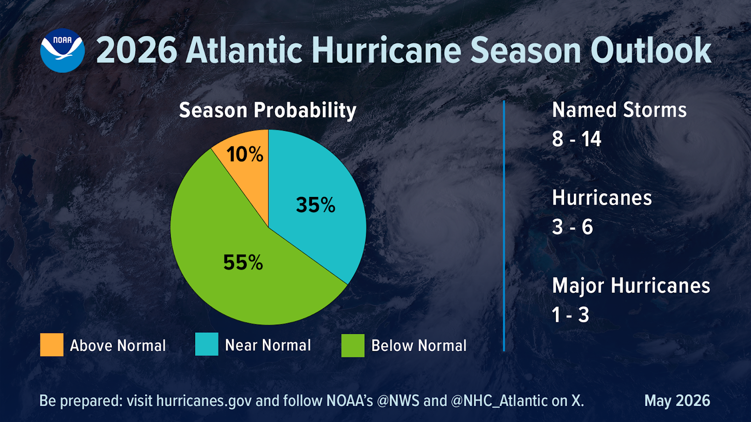
NOAA's official outlook calls for a 55% chance of a below-normal season, forecasting:
8 to 14 named storms
3 to 6 hurricanes
1 to 3 major hurricanes (Category 3 or stronger)
For comparison, an average Atlantic hurricane season produces about 14 named storms, 7 hurricanes, and 3 major hurricanes.
The El Niño Factor
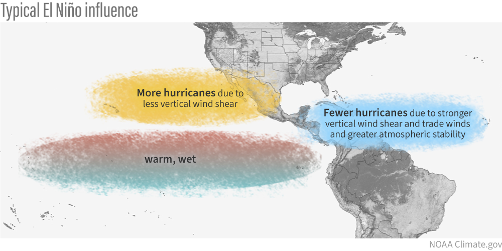
One of the biggest reasons forecasters expect a quieter season is the anticipated development of a strong El Niño, with NOAA indicating a very high probability that El Niño conditions will be present during the heart of hurricane season. Some forecast guidance even suggests the event could become exceptionally strong by late summer and fall.
El Niño occurs when ocean waters across the central and eastern tropical Pacific become warmer than average. While that warming happens thousands of miles away from the Atlantic, it can dramatically influence hurricane activity.
During El Niño years:
Upper-level winds across the Atlantic become stronger.
Vertical wind shear increases.
Developing tropical systems are more likely to be disrupted.
Hurricanes often struggle to organize and intensify.
Think of it as atmospheric turbulence. Hurricanes prefer a calm, stable environment from the ocean surface to the upper atmosphere. When wind speeds and directions change significantly with height, storms can become tilted and weakened before they reach their full potential.
Why Forecasters Are Still Paying Close Attention
A quieter season does not necessarily mean a harmless season.
History has shown that it only takes one hurricane making landfall in a populated area to create a devastating year. Even in seasons with below-average storm counts, major hurricanes can still form and impact coastal communities. NOAA and the National Hurricane Center continue to emphasize preparedness regardless of seasonal forecasts.
Additionally, Atlantic sea surface temperatures remain warmer than average in many areas. While El Niño tends to suppress overall storm numbers, exceptionally warm water can sometimes help individual storms intensify rapidly if atmospheric conditions briefly become favorable.
Why Should Minnesotans Care?
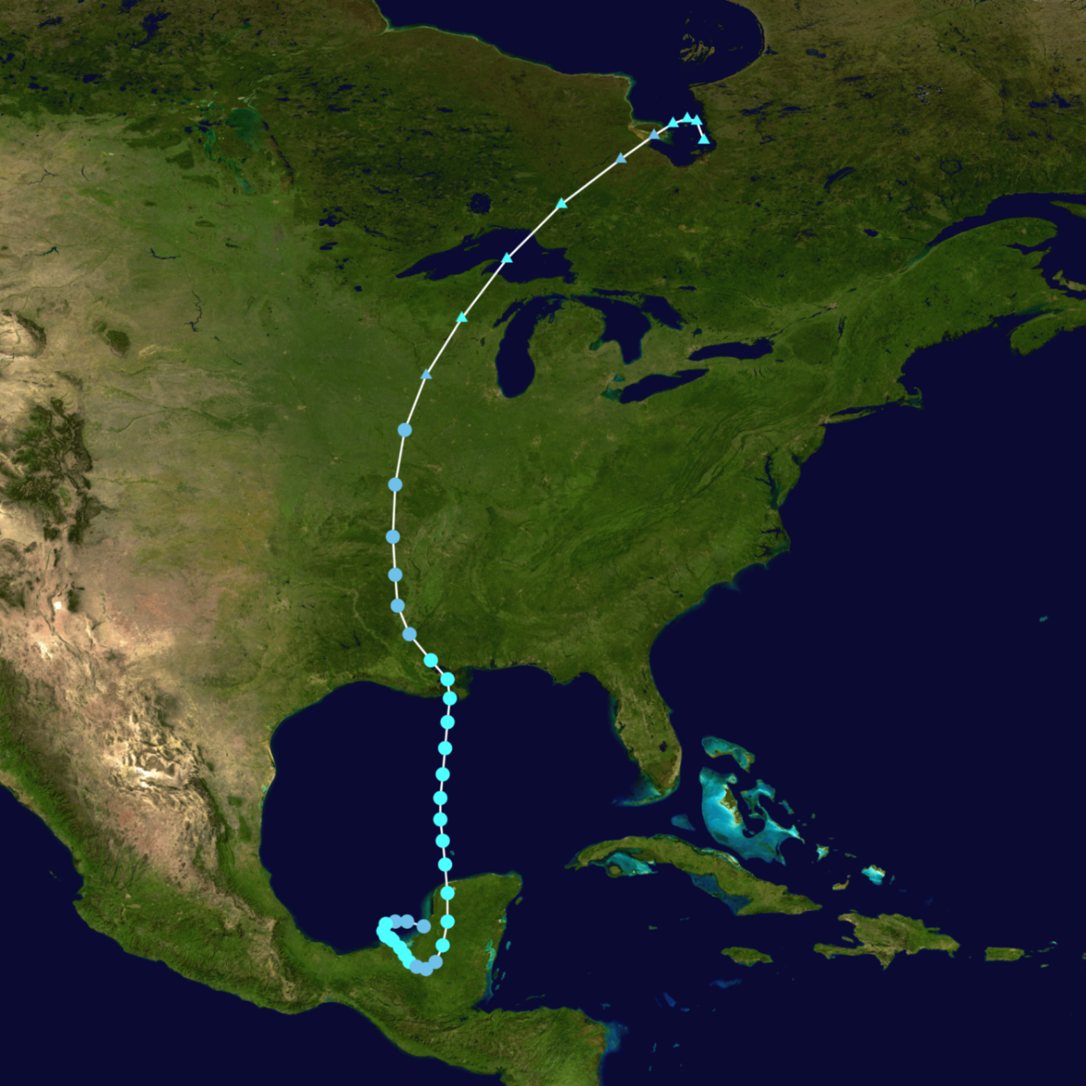
Even though Minnesota is far from hurricane-prone coastlines, tropical systems can still affect the Upper Midwest. The remnants of hurricanes occasionally track northward into the Mississippi Valley, bringing heavy rainfall, flooding concerns, and even tornado outbreaks.
Former hurricanes have delivered significant rainfall events to portions of Minnesota and Wisconsin, demonstrating that the impacts of tropical systems can extend hundreds or even thousands of miles from where they first made landfall.
Whether the 2026 season ends up quiet or active, the Atlantic Hurricane Season remains one of the most closely watched weather phenomena on Earth and it all begins June 1st.
Meteorologist Todd Nelson