Stormy Days Ahead With Severe Weather And Heavy Rain
SEVERE THREAT FRIDAY
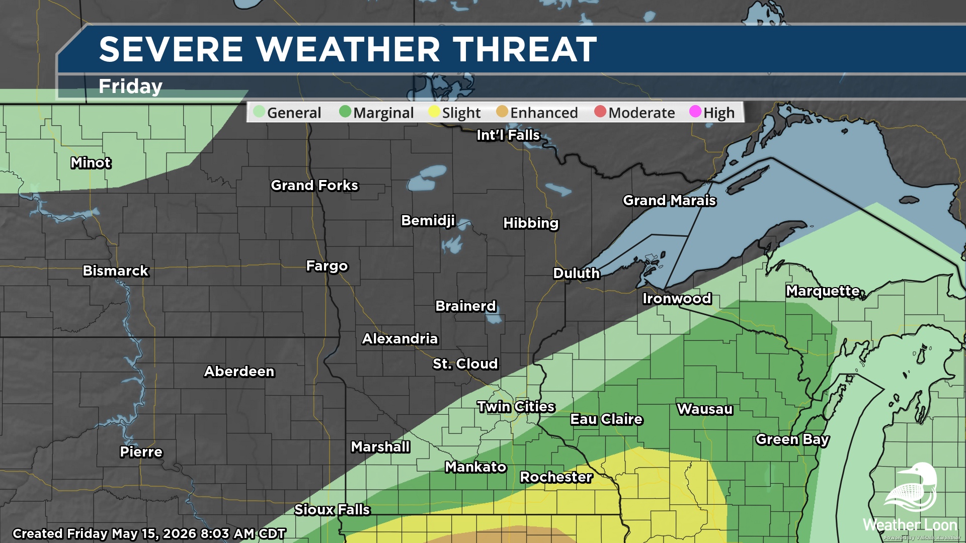
We are tracking the threat of severe weather over the next several days across the state of Minnesota. The threat begins today (Friday, May 15, 2026) with a Marginal to Slight Risk (threat level 1-2 of 5) of severe weather across southeast Minnesota - mainly south of the metro, but including Mankato and Rochester.
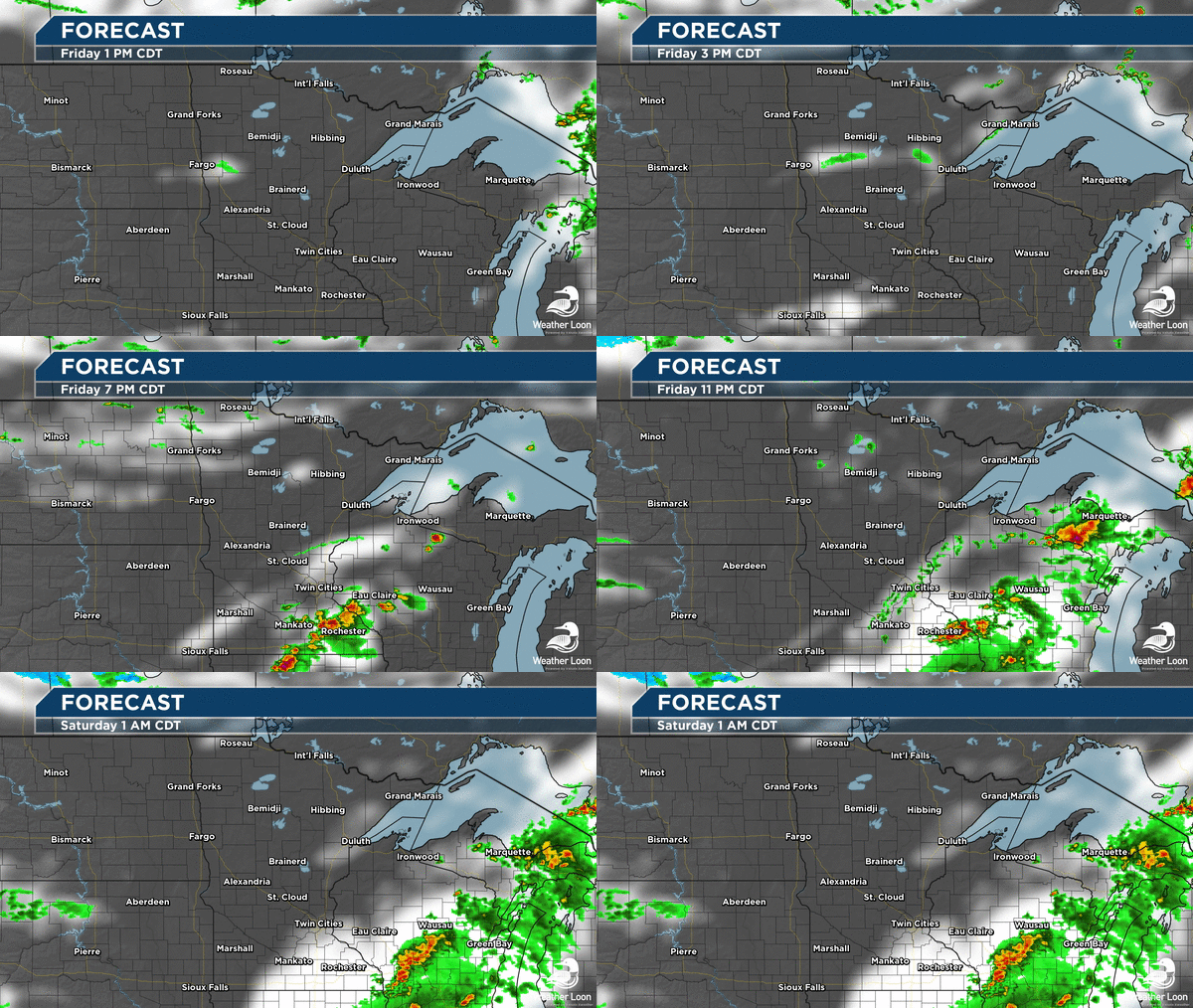
A cold front draped across southern Minnesota will spark isolated thunderstorms late this afternoon into the evening hours, mainly across southeastern/south-central Minnesota into southwestern Wisconsin. Large hail will be the primary threat, but damaging wind gusts are also possible.
SEVERE THREAT SUNDAY
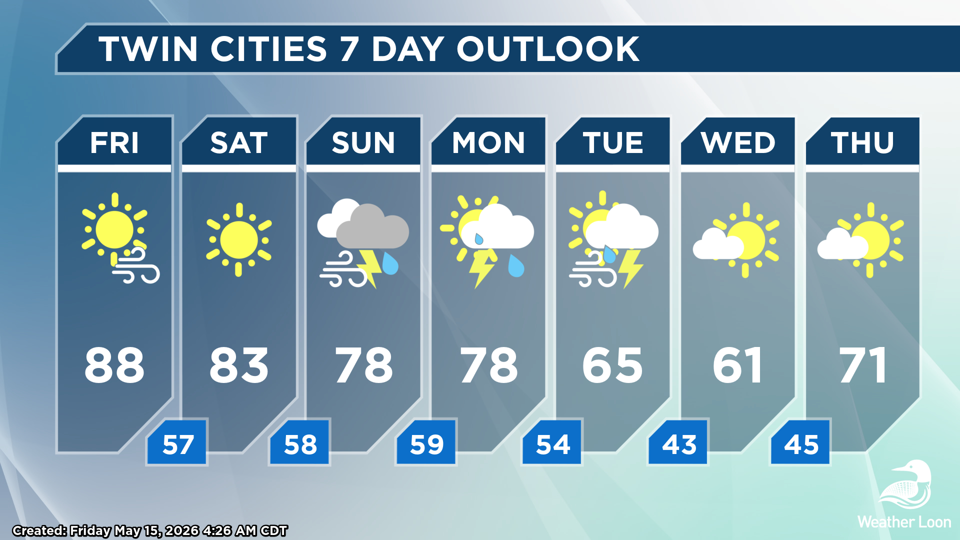
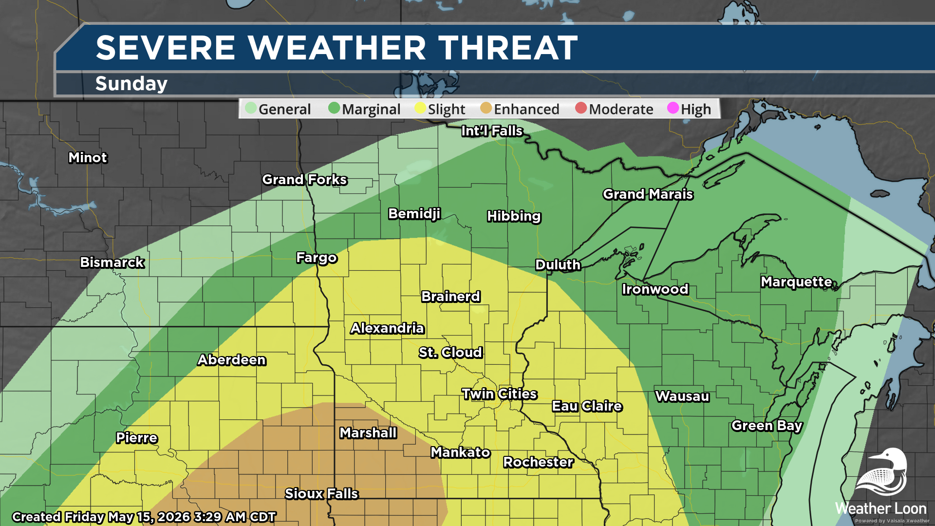
While we will get a break in the severe weather potential on Saturday (May 16, 2026), the threat will start to ramp up once again heading into the second half of the weekend. Most of the southern two-thirds of Minnesota is under a Slight Risk of severe weather Sunday (May 17, 2026) into Sunday Night, with an Enhanced Risk (threat level 3/5) in place in southwest Minnesota, including Marshall and Worthington. While morning storms could pose a hail threat, discrete supercell thunderstorms are expected to fire over the Dakotas and Central Plains during the afternoon, then merge into a fast-moving squall line that will move through Minnesota during the evening/overnight hours. Current models show most of this storm activity occurring after sunset and into the overnight hours, which means having multiple ways to receive severe weather information while sleeping will be critical. Damaging winds appear to be the main threat Sunday Night, but we may have to watch particularly western Minnesota for a tornado or hail threat depending on storm mode and timing.
SEVERE THREAT MONDAY

The severe weather threat will continue into Monday, with the equivalent of an Enhanced Risk of severe weather across southeastern Minnesota and a Slight Risk extending to the Duluth area. While a larger severe weather outbreak may occur across parts of the Central Plains, storms are expected to fire with a cold front across the Upper Midwest in the afternoon and evening hours. These will be capable of a widespread damaging wind threat, a few tornadoes (some potentially strong), and large hail. There is some uncertainty in the timing of the cold front passage, which would have an impact on severe weather potential. Make sure you stay tuned to the WeatherLoon live stream throughout the weekend and early next week for the latest on timing out storms and the severe weather threat.
HEAVY RAIN THREAT
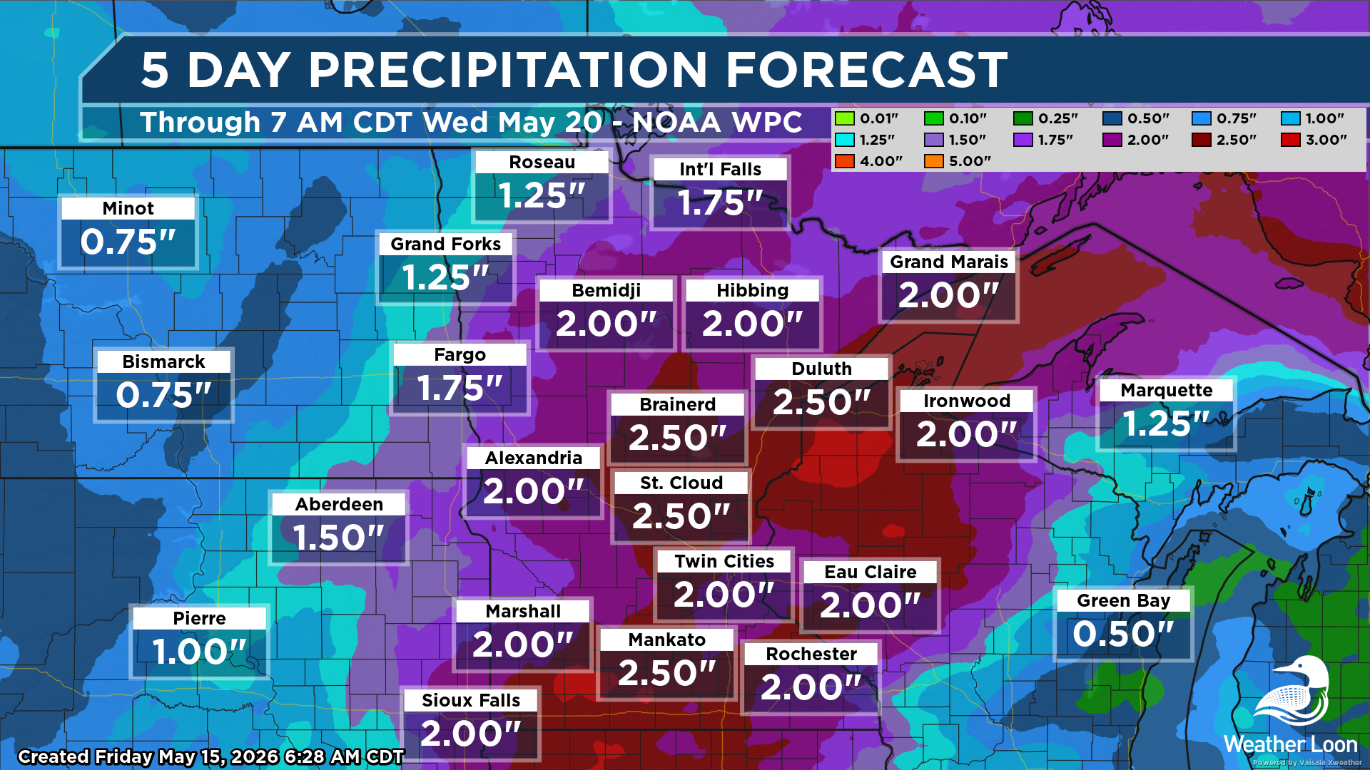
We are also expecting soaking rains with these storms, especially Sunday into Monday. Many areas of the state could pick up at least 1-3" of rain over the next five days. We will welcome the rain and hope that it helps to dent areas of growing dryness across Minnesota, as well as the fire weather threat. However, this amount of rain in a short amount of time could pose a flash flood threat, and that will also have to be monitored on Sunday and Monday.