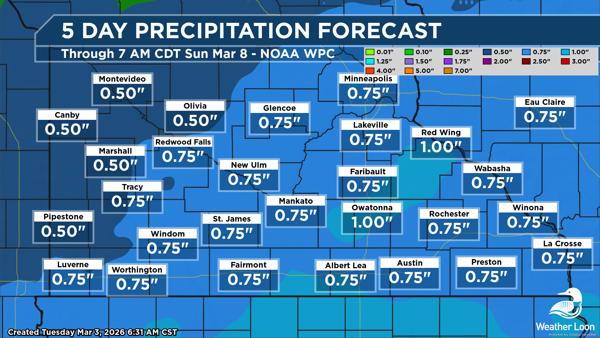
System To Bring Heavy Rain, Potentially Strong Storms Later This Week
We are watching the potential for some early March heavy rain and strong storms later this week across southern Minnesota - not what we would typically think we'd be saying this time of year!
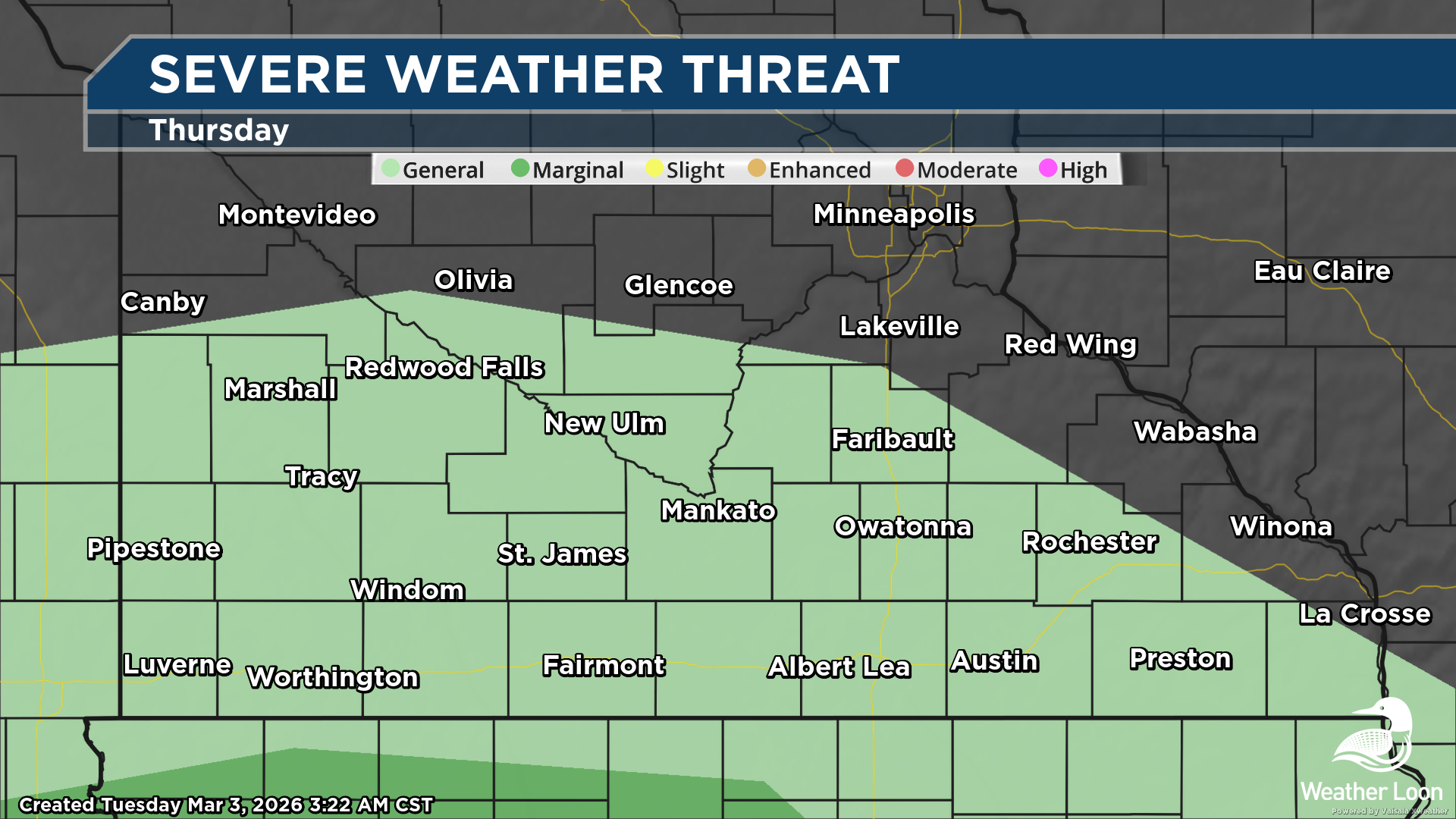
First, the severe threat looks to mainly stay south of Minnesota Thursday into Thursday Night, with a Marginal Risk of severe weather (threat level 1/5) for areas as far north as Spencer, IA. However, on Thursday night, we could see a few thunderstorms as far north as the Granite Falls area.
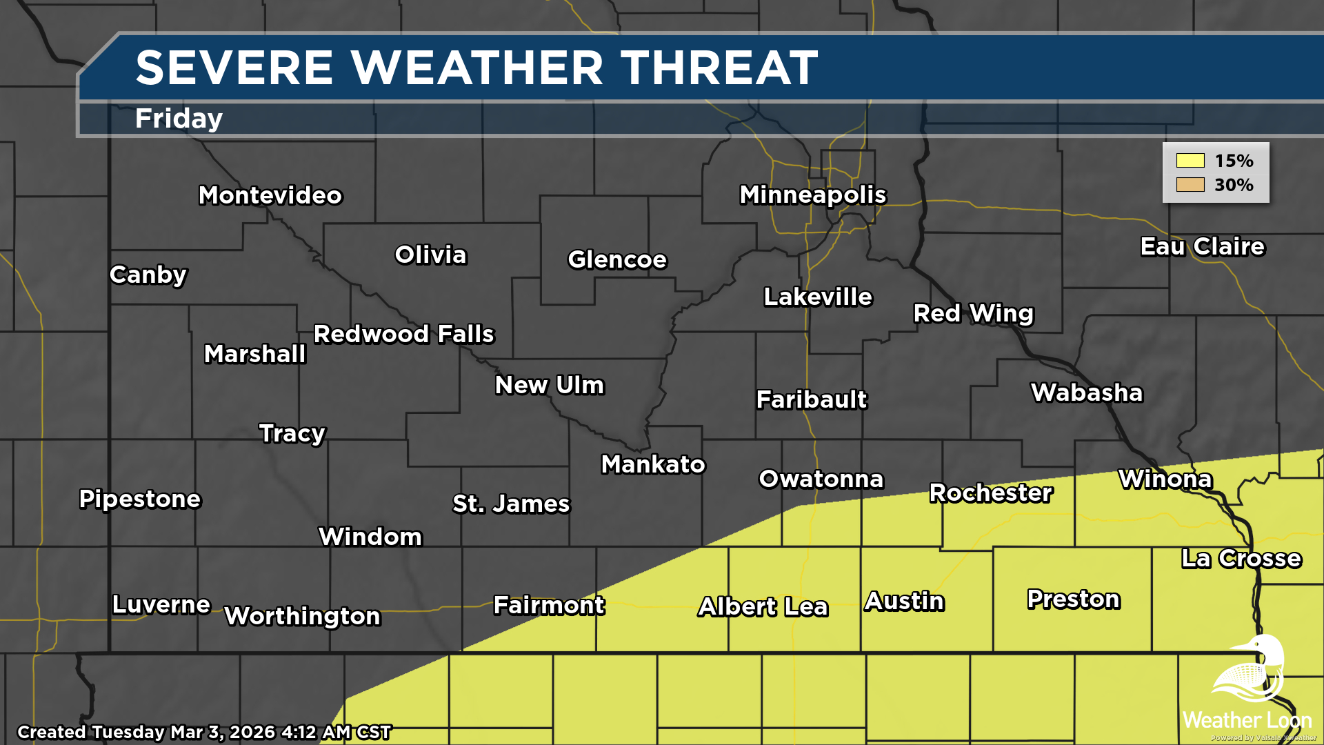
Heading into Friday, however, we could see a few strong storms across south-central and southeastern Minnesota, with an equivalent Slight Risk (threat level 2/5) as far north as Rochester and Winona. We would likely be looking at mainly a hail threat this far north, but across parts of the central United States (toward Kansas City and Oklahoma City), more significant severe weather could occur.
This system will also bring the potential of heavy rain to the region between Thursday Night and Saturday. Guidance shows the potential of an inch or so of rain in spots, backed by the potential of a few thunderstorms. Since there is some remaining frost in the ground (even with the recent warmer weather), we will have to watch for additional runoff from this heavier rainfall and the potential of some rising creeks and streams in southern and eastern Minnesota.